Overview
The Division of Fish & Wildlife has compiled this interactive map to assist hunters in identifying potential hunting locations. While every effort is made to ensure the accuracy and reliability of the information provided, errors or updates may occur. Therefore, we encourage hunters to verify details before heading out into the field.
Important Disclaimer
We strive to present correct and up-to-date information regarding hunting locations, but we cannot guarantee the accuracy or suitability of the data displayed, including referenced or linked information. It is always recommended to check with property managers or landowners to confirm hunting rules and regulations.
Boundary and Access Information
• Approximate Boundaries: The displayed property boundaries are intended as general guidelines. They may not accurately represent all areas where hunting is permitted.
• Access Sites: All locations listed are approximate. Before planning your trip, confirm that the site is open to the public and that hunting is allowed.
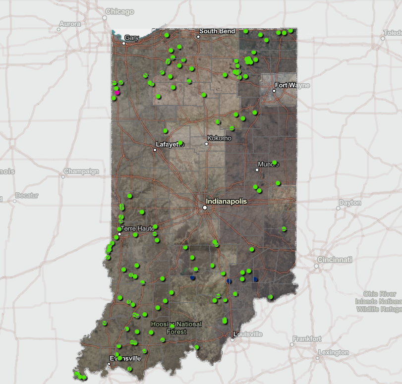
SOURCE : https://experience.arcgis.com/experience/88e4745e813c4d3b9fb7e50084280f4e
• Hunting Rules & Regulations: Hunting policies vary by location. Always check with the appropriate authorities or landowners to ensure compliance with all local regulations.
Plan Ahead for a Safe and Responsible Hunt
To ensure a successful and lawful hunting experience, follow these guidelines:
✔ Verify property boundaries and permitted hunting areas.
✔ Contact local wildlife agencies or property managers for updated rules.
✔ Respect private property and obtain permission when necessary.
✔ Follow all state and local hunting laws for a safe and ethical hunt.
For more information, visit the Division of Fish & Wildlife’s official website or use the interactive map to explore available hunting locations.